
In the Texas Hill Country, a property's water well is not just a utility , it is the difference between a functional homestead and a $20,000 drilling emergency. Unlike municipal water systems, where the city handles infrastructure and quality, a private well places every aspect of water supply on the property owner. The well log is the only objective record of what exists underground, how the well was constructed, and whether it produces enough water to support the household. Yet in the majority of residential transactions across Kendall, Bexar, and Comal counties, buyers sign contracts without ever reading the well report. Here is what that document actually contains, why it matters, and how to interpret it without a geology degree.
What a well log actually is
A well log , technically a driller's report , is a legal document filed with the Texas Department of Licensing and Regulation (TDLR) by the licensed water well driller who constructed the well [1]. Texas Administrative Code Rule 6.110 requires every licensed driller to submit a report within 30 days of completing a well, and the report must include specific construction, geological, and performance data [2].
The well log serves multiple purposes: it documents compliance with state construction standards, records the geological formations encountered during drilling, provides the measured yield and static water level, and creates a permanent public record of the well's location and specifications [1]. For buyers, it functions as a medical record for the property's water supply , the objective baseline that either confirms a healthy well or reveals problems the seller may not have disclosed.
The seven data points that matter most
A well log contains more than a dozen fields of information, but seven data points carry the most weight for a property buyer evaluating water supply:
Key Well Log Data Points for Buyers
| Data Point | What It Tells You | Hill Country Benchmark |
|---|---|---|
| Total Well Depth | How deep the borehole extends into the formations | 300âÂÂ800+ ft typical in Kendall County |
| Static Water Level | Depth from surface to standing water in the well | 50âÂÂ200+ ft below surface |
| Yield / Flow Rate (GPM) | Gallons per minute the well produces under test | 5âÂÂ40 GPM (below 3 GPM is problematic) |
| Lithology / Geological Log | Rock and soil layers encountered at each depth | Limestone, clay, sandstone, fractured zones |
| Casing Diameter & Depth | Steel or PVC pipe that lines and protects the borehole | Must extend past surface contamination zones |
| Grouting / Sealing | Whether the annular space was sealed to prevent surface water intrusion | Required within 20 ft of surface per TDLR rules |
| Driller's License Number | Confirms the work was done by a licensed professional | Verify on TDLR website |
Source: Texas Administrative Code ç6.110; TDLR water well reporting requirements. Hill Country benchmarks based on TWDB groundwater data for Kendall, Bexar, and Comal counties.
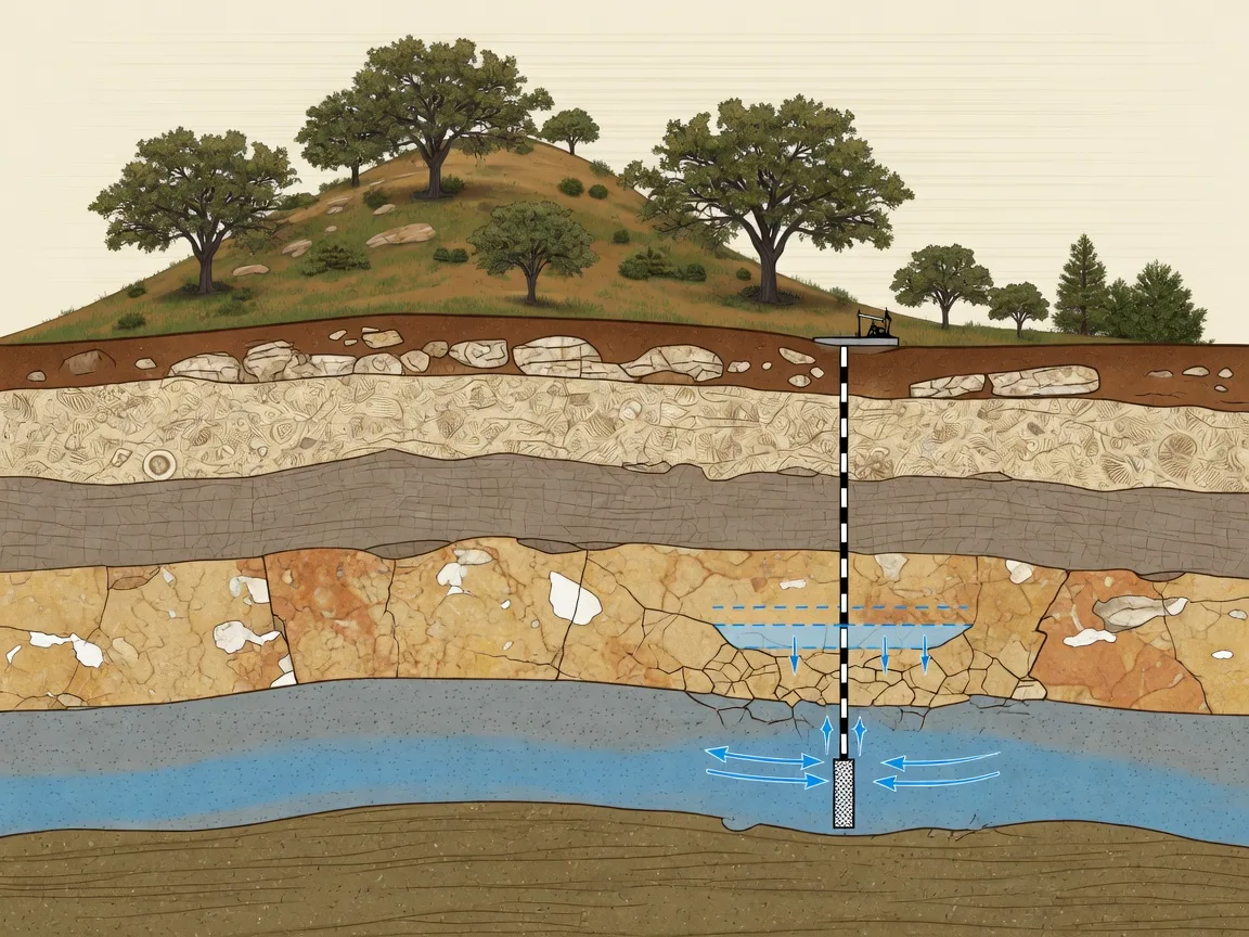
Total well depth is the starting point, but depth alone is misleading. A 600-foot well in the Edwards Aquifer recharge zone and a 600-foot well in the Cow Creek limestone formation will behave very differently. The depth tells you how far the driller went; the lithology tells you what they found.
Static water level measures the distance from the ground surface to the water standing in the well when the pump is not running [3]. This number is the closest thing to a real-time aquifer health check. A static water level of 80 feet in a 400-foot well means there are 320 feet of water column , a strong well. A static water level of 350 feet in a 400-foot well means only 50 feet of water column , a marginal well that may struggle during drought [3].
Yield (gallons per minute) is the number that determines whether the well can actually support a household. Most Texas well drillers perform a yield test , pumping the well at a controlled rate for a set period and measuring drawdown [1]. A yield of 10 GPM comfortably serves a typical four-bedroom home with standard fixtures. Below 5 GPM, water conservation becomes necessary. Below 3 GPM, supplemental storage tanks and demand management are required [4].
The lithology column: reading the geological story
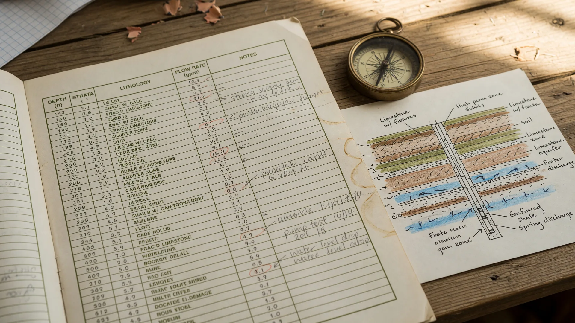
The lithology section is the most technical part of a well log, and for most buyers, the most confusing. It is a layer-by-layer description of every rock formation and soil type the drill bit encountered from the surface down to total depth [1]. In a Hill Country well log, you will typically see entries like:
Sample Lithology Log: Kendall County Well
| Depth Range | Formation / Material | What It Means |
|---|---|---|
| 0âÂÂ15 ft | Topsoil and decomposed limestone | Surface layer; potential contamination zone |
| 15âÂÂ80 ft | Dense limestone, occasional clay seams | Shallow Edwards formation; may contain water |
| 80âÂÂ250 ft | Fractured limestone with water-bearing zones | Primary aquifer zone; where most yield comes from |
| 250âÂÂ380 ft | Massive limestone, lower porosity | Reduced water potential; deeper drilling adds cost |
| 380âÂÂ420 ft | Fractured zone with artesian pressure noted | Deep aquifer contact; high-quality water source |
This is a representative example for educational purposes. Actual lithology varies significantly across the Hill Country depending on location relative to the Edwards Aquifer recharge, catchment, and contributing zones [3][5].
The key question to ask when reading the lithology: at what depth did the driller encounter water-bearing formations, and how much water did those formations produce? A well that hits productive fractured limestone at 80 feet and continues through multiple water-bearing zones to 400 feet tells a fundamentally different story than a well that punches through 300 feet of dense, non-porous limestone before hitting a thin water zone at 350 feet [3][5].
The lithology also reveals whether the well passes through clay layers, which can act as confining barriers between aquifer zones. In some Hill Country locations, a thick clay seam between two limestone formations means the upper and lower zones are hydrologically isolated , water in the upper zone may not replenish from the lower zone during drought [5]. This is the kind of structural detail that affects long-term water security and is invisible without the well log.
Where to find well logs in Texas
Texas maintains multiple public databases of well records, and accessing them is straightforward. The primary resource is the Texas Water Development Board (TWDB) Submitted Driller's Reports (SDR) Database, which contains over 680,000 well reports filed since 2001 [6].
For wells drilled after 2001, the TWDB SDR database is searchable by county, owner name, latitude/longitude, or physical address [6]. Reports are available as downloadable PDFs that include the full driller's report, lithology log, and construction details. For pre-2003 wells , which includes many older Hill Country properties , the TCEQ Water Well Report Viewer provides a map-based interface for locating scanned historical reports [7].
How to Find Your Property's Well Log
| Source | Coverage | Access |
|---|---|---|
| TWDB SDR Database | Wells drilled 2001âÂÂpresent (680,000+ reports) | Free PDF downloads; searchable by address or coordinates |
| TCEQ Water Well Report Viewer | Pre-2003 historical well reports | Map-based interface; scanned PDF reports |
| Seller Disclosure | Seller-provided documentation | Request during option period; verify against public database |
| Local Well Drillers | Recent service or repair records | Contact driller listed on the original report |
Source: TWDB , Submitted Driller's Reports Database; TCEQ Water Well Report Viewer. Database access is free and does not require registration.
A practical approach: during the option period, request the seller's well log documentation and cross-reference it against the TWDB database. The seller's copy may be incomplete or outdated, and the public database provides an independent verification of what was filed with TDLR [6]. If no well log exists in either source , which occurs on some older properties , that itself is a material finding that should trigger a professional well inspection before closing.
What the well log reveals about property value
In the Hill Country, water availability is not an amenity , it is a structural component of property value. A well producing 20 GPM from productive Edwards Aquifer limestone at a depth of 350 feet supports a fundamentally different property valuation than a well producing 3 GPM from tight formations at 600 feet [4].
The market impact is measurable. Properties with documented high-yield wells (above 10 GPM) in Kendall County command a premium over comparable parcels with marginal or undated wells , because a reliable water supply eliminates the risk and cost of drilling a new well, which runs $12,000 to $25,000 or more depending on depth and geology [4][8]. A property with no well at all, where the buyer must plan and budget for new construction, typically sells at a discount relative to a property with a proven water supply.
The well log also affects septic system feasibility. Texas Commission on Environmental Quality (TCEQ) rules require a minimum separation distance between a well and a septic system drain field , typically 50 feet from a water well to the nearest edge of a septic drain field [9]. A well log that shows the well is located closer to an existing septic system than the required setback may indicate a compliance issue that requires remediation. This interaction between wells and septic is covered in detail in our guide to aerobic septic systems in the Hill Country.
Common red flags in Hill Country well logs
Experienced water well professionals and Hill Country real estate practitioners recognize several patterns in well logs that signal elevated risk:
Low yield with no supplemental storage noted. A well producing 2âÂÂ4 GPM with no documented storage tank or booster system means the household will experience pressure drops during high-demand periods. This is a functional limitation that affects livability and should be priced into the purchase [4].
Missing or incomplete lithology. A well log that omits the geological description column , listing only the total depth and yield , provides insufficient information to evaluate aquifer conditions. This sometimes occurs on older reports or with less experienced drillers [1]. Incomplete logs should be supplemented with a professional well inspection.
High static water level with declining yield. A static water level at 60 feet but a tested yield of only 3 GPM suggests a narrow or fractured water zone that produces water slowly. The well may fill over time but cannot sustain continuous demand , a condition that worsens during drought [3][5].
Well depth significantly deeper than neighboring wells. If the well log shows a total depth of 700 feet on a street where neighboring wells average 350 feet, this suggests the driller encountered difficulty finding adequate water and had to go deeper. It may also indicate that the property sits in a geological transition zone with less reliable aquifer access [5].
Casing that does not extend to the required depth. TDLR rules require well casing to extend below the depth of potential surface contamination , typically at least 20 feet below ground surface, with grouting to seal the annular space [2]. A well log showing inadequate casing depth may indicate a contamination risk from surface water intrusion. This is particularly important in karst limestone terrain, where surface water can travel rapidly through fractures [5].
Well Log Red Flags Checklist
When a well log is not enough
Even a complete well log provides a snapshot in time , the conditions on the day the well was drilled. Aquifer conditions change. Water levels fluctuate with drought cycles, seasonal demand, and long-term aquifer drawdown [3]. A well that tested at 15 GPM when drilled in 2015 may produce 6 GPM in 2026 if the Edwards Aquifer has experienced sustained drawdown.
For this reason, the well log should be treated as the starting point for evaluation, not the final word. A professional well inspection , typically costing $300 to $500 , includes a current flow test, pressure test, and evaluation of the pump, pressure tank, and electrical connections [4]. This inspection provides real-time performance data that complements the historical well log.
In areas near the Edwards Aquifer recharge zone, the current J-17 index well level should be reviewed alongside the well log. The J-17 measurement , tracked daily by the Edwards Aquifer Authority , reflects real-time aquifer conditions across the San Antonio segment. When J-17 drops below 660 feet above mean sea level, Stage 1 pumping restrictions apply; below 640 feet, Stage 2 restrictions reduce permitted withdrawals [3]. A well log showing strong performance during a wet year may not reflect drought-year reality.
Well logs and the Edwards Aquifer: the connection buyers need to understand
The Edwards Aquifer is a karst limestone system , water moves through dissolved fractures, caverns, and interconnected voids rather than through uniform porous rock [3][5]. This geological structure means that two properties 500 feet apart can have dramatically different well performance based on whether the well intersected a productive fracture network or hit a dense, non-porous limestone block.
The well log's lithology column is the primary indicator of what kind of aquifer contact the well achieved. Wells that encounter multiple fractured limestone zones with reported water inflow at different depths tend to be more resilient during drought than wells that rely on a single thin water zone [5]. A buyer evaluating two properties at similar price points should compare the lithology logs , not just the total depth and yield , to assess which well has the more durable aquifer connection.
The Edwards Aquifer buyer guide covers aquifer fundamentals in detail, but the well log is the document that translates those regional aquifer conditions into site-specific performance data for the exact property under contract.
Properties without well logs: what to do
Some Hill Country properties , particularly older homes on smaller acreage or properties served by a shared well , may not have a well log on file in the TWDB database. This occurs for several reasons: the well may predate the 2001 reporting requirement, the driller may have failed to file the report (a TDLR compliance violation), or the property may be served by a shared well with separate ownership [1][6].
In these situations, a professional well inspection becomes essential. The inspector will evaluate the well's visible components , casing condition, cap seal, electrical connections, and pump operation , and can perform a flow test to determine current yield [4]. Without a well log, the buyer has no historical baseline and must rely entirely on current performance data and the inspector's assessment of the well's condition.
For shared wells, the absence of a well log is particularly concerning because shared well agreements , which govern water allocation, maintenance responsibilities, and access rights , should reference the well's documented capacity [9]. Without a well log confirming the well's yield, the shared agreement's allocation assumptions may not reflect actual supply.
Considering a Hill Country property with a private well?
Understanding well logs, aquifer conditions, and water supply infrastructure is part of every property evaluation. A direct conversation about the specific property , its well history, geology, and water security , provides the context needed to make an informed decision.
Contact Bill Ross | Wells & Edwards AquiferFrequently asked questions
How do I find a well log for a specific Hill Country property?
Search the Texas Water Development Board (TWDB) Submitted Driller's Reports Database at twdb.texas.gov using the property's address, county, or latitude/longitude coordinates. The database contains well reports filed from 2001 to the present and provides free PDF downloads. For wells drilled before 2003, use the TCEQ Water Well Report Viewer, which provides a map-based interface for locating scanned historical reports [6][7]. You can also request the seller's well documentation during the option period and cross-reference it against the public database.
What is a good flow rate for a Hill Country well?
For a single-family household, a minimum of 5 GPM is considered adequate with conservative water management. A flow rate of 10 GPM or above provides comfortable margin for a four-bedroom home with standard fixtures, outdoor irrigation, and guests. Below 3 GPM, supplemental storage tanks and demand management strategies are typically required. Flow rates in Kendall County residential wells generally range from 5 to 40 GPM, with significant variation based on geological conditions and well depth [3][4].
Can a well log predict whether my well will run dry during a drought?
A well log provides the historical baseline , the depth, yield, and static water level at the time of drilling , but it does not predict drought performance with certainty. Aquifer levels fluctuate with rainfall, seasonal demand, and long-term drawdown. A well log showing strong yield during wet conditions may underperform during extended drought. The best supplemental data point is the Edwards Aquifer Authority's J-17 index well level, which reflects current aquifer conditions across the San Antonio segment. Reviewing the J-17 level alongside the well log provides a more complete picture [3][5].
What if the property has no well log on file?
If no well log exists in the TWDB or TCEQ databases, a professional well inspection is essential. The inspection provides a current flow test, pressure evaluation, and assessment of the well's physical condition. Without a well log, there is no historical baseline , making the current inspection the only available data source. For post-2001 wells, the absence of a filed report may indicate a TDLR compliance issue by the original driller [1][6].
How does a well log affect septic system approval?
TCEQ and local health authorities require a minimum separation distance between a private water well and a septic system drain field , typically 50 feet from the well to the nearest edge of the drain field [9]. The well log documents the well's exact location and construction, which is necessary for verifying compliance. A property where the well and septic are closer than the required setback may require system relocation or a variance, both of which add cost and complexity. This interaction is covered in our guide to aerobic septic systems in the Hill Country.
Do I need a well inspection even if the well log looks good?
Yes. The well log is a historical document , it records conditions at the time of drilling, which may have been years or decades ago. A professional well inspection provides current performance data, evaluates the pump and pressure system, checks the casing and cap condition, and identifies any deterioration or code compliance issues that have developed since the original drilling. Budget $300 to $500 for a comprehensive inspection, which is modest relative to the cost of discovering an underperforming well after closing [4].
__UNIQUE_SOURCES_MARKER__ class="space-y-3 text-[14px] leading-relaxed list-decimal list-inside">
Last verified: July 6, 2026
Published July 6, 2026
Updated July 6, 2026