
If you are buying acreage in the Texas Hill Country and the property is not served by municipal water, the well is the single most important piece of infrastructure you will evaluate. It provides every drop of water for your household, your landscaping, and your livestock. Unlike a roof or an HVAC system, a well cannot be replaced with a simple phone call. Drilling a new well in Kendall County limestone can cost $10,000 to $25,000, and the outcome is never guaranteed until the drill bit hits water [1].
This guide is written for buyers who are new to the Hill Country and need to understand what well depths, aquifer levels, and well completion reports actually tell you. I have walked enough out-of-state buyers through this evaluation to know that the people who make confident decisions are the ones who understand the data before they make an offer.
The two aquifers that matter in the Hill Country
The Hill Country sits atop two major groundwater systems that behave very differently. Understanding which one your property draws from is the first step in evaluating a well.
The Edwards Aquifer is a karst limestone aquifer characterized by fractures, conduits, and caverns that allow water to move rapidly through the rock. Wells in the Edwards typically range from 150 to 300 feet deep and commonly produce 50 to 200 gallons per minute (GPM) where they intersect productive fracture zones [2]. The Edwards Aquifer supplies water to over two million people in the San Antonio region and is one of the most productive limestone aquifers in the United States [3]. Water quality is generally excellent: the water is fresh, minimally mineralized, and requires only standard hardness treatment.
The Trinity Aquifer underlies the Edwards in many areas and extends across the Hill Country where the Edwards is absent. Trinity wells are typically deeper, ranging from 300 to 650 feet, and yields are lower, generally under 20 GPM [4]. The Trinity is also a fractured-rock system, which means yields vary dramatically even over short distances. A well on one side of a road may produce 50 GPM while a well a quarter mile away produces 5 GPM, depending entirely on whether the drill bit intersected a productive fracture zone [4]. Water quality in the Trinity is more mineralized, with higher levels of dissolved solids, sulfate, and chloride [5].
Edwards vs. Trinity Aquifer: Key Differences for Homebuyers
| Characteristic | Edwards Aquifer | Trinity Aquifer |
|---|---|---|
| Typical Well Depth | 150-300 feet | 300-650 feet |
| Typical Yield (GPM) | 50-200 GPM | 5-20 GPM (variable) |
| Water Quality | Fresh, low mineralization | Higher TDS, sulfate, chloride |
| Drought Sensitivity | High (rapid response to rainfall) | Moderate (slower response) |
| Typical Annual Cost to Treat Water | $300-600 (softener) | $600-1,200 (softener + filtration) |
Sources: Texas Water Development Board [2][4], USGS Edwards-Trinity Aquifer Study [5]. Yields are typical ranges; individual well performance varies significantly based on local fracture patterns.
For properties in Kendall County, the distribution of these aquifers varies by location. The Edwards Aquifer underlies the eastern portion of the county, including parts of Fair Oaks Ranch and the area along I-10 toward San Antonio. The Trinity Aquifer underlies western Kendall County, including areas around Center Point and westward toward Kerrville [6]. Boerne sits in a transition zone where both aquifers may be present at different depths.
How to read a well completion report
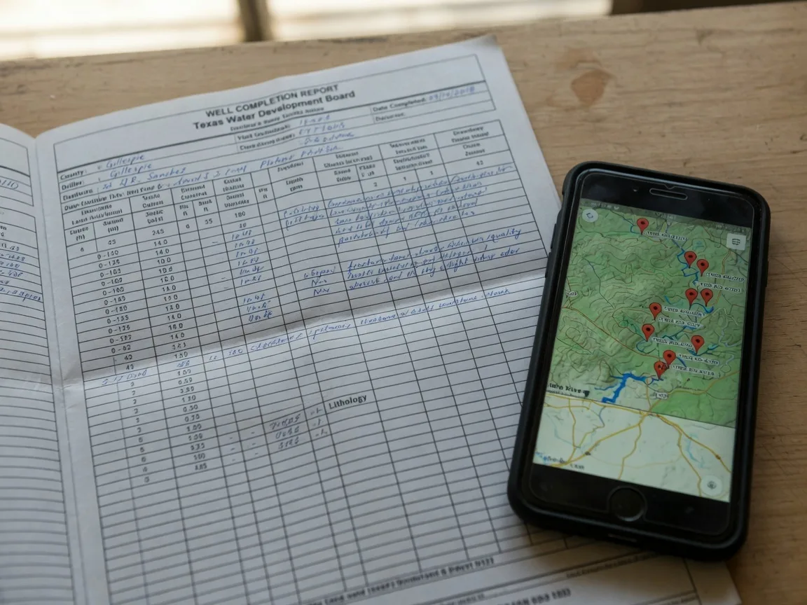
Every well drilled in Texas since 2003 is required to have a Driller's Report (TDLR Form 001) submitted to the Texas Water Development Board (TWDB) [7]. This document is the most important piece of paper you will review when evaluating a property with a private well. Here is what each section tells you.
Total well depth. This is the distance from the ground surface to the bottom of the drilled hole. In the Edwards Aquifer, depths of 150 to 300 feet are typical. In the Trinity, 300 to 650 feet is common [2][4]. A well that is significantly deeper than the neighborhood average may indicate that the driller had to chase the water table downward, which can be a warning sign of declining aquifer levels.
Static water level (SWL). This is the depth from the ground surface to the top of the water column when the well is at rest, not being pumped. A shallower SWL relative to total depth suggests a productive aquifer with good saturated thickness. The difference between the SWL and the total depth tells you how much water-bearing rock is available. A well with a total depth of 400 feet and a SWL of 380 feet has only 20 feet of saturated thickness, which means the well has minimal margin before it goes dry [7][8].
Well yield (GPM). The pumping rate measured at the time of completion tells you how much water the well can produce on a sustained basis. For a standard four-bedroom home, 5 to 10 GPM provides comfortable margin for simultaneous showers, laundry, and irrigation. Below 5 GPM, conservation becomes a daily consideration. Below 3 GPM, you need supplemental storage tanks to buffer peak demand [1][8].
Casing depth and diameter. The casing seals off the upper portion of the borehole to prevent surface contaminants and shallow groundwater from entering the well. In Texas, the minimum casing depth is typically 20 feet below the ground surface, though deeper casing is required in areas with poor shallow water quality [7]. The casing should extend into competent bedrock to create a proper seal.
Aquifer identification. The driller notes which aquifer the well is producing from. This tells you which regulatory framework applies and what water quality characteristics to expect. The TWDB maintains detailed aquifer data for each formation in Texas [2][4].
Formation log. The driller's description of rock types encountered at each depth interval. In the Hill Country, you expect to see limestone, dolomite, and marl. The presence of clay or shale layers may indicate lower permeability zones. The log should show where water-bearing fractures were encountered [7].
What the numbers actually mean for your property
Here is the practical framework I use with every buyer when reviewing a well report.
Yield below 5 GPM is a real constraint. A well producing 3 GPM can support a household, but it requires careful water management. You cannot run the sprinkler system while someone is showering. You cannot fill a hot tub or a swimming pool in a reasonable timeframe. You need a storage tank to buffer peak demand, and that tank needs to be sized for your household's maximum daily usage, typically 1,500 to 3,000 gallons for a family of four [1][8].
Yield above 10 GPM is comfortable. Most Edwards Aquifer wells in Kendall County produce well above this threshold. If you are looking at a property on the Edwards, you can generally expect abundant water with standard treatment.
Yield above 50 GPM is excellent. This is common in the Edwards and rare in the Trinity. Properties with yields at this level can support irrigation systems, livestock, and even small-scale agricultural operations without concern [3].
The static water level trend matters more than the depth. A single SWL reading tells you the water level on the day the well was drilled. What matters is whether the aquifer level in that area has been declining year over year. The TWDB maintains historical water level data for monitoring wells across the state. The Edwards Aquifer Authority publishes the J-17 index well data, which showed a 10-day rolling average of approximately 644.8 feet above mean sea level in mid-2026, reflecting significant recovery from the record low of 624.7 feet recorded in May 2025 [9].
Well Yield Benchmarks for Hill Country Homebuyers
| Yield (GPM) | What It Supports | Assessment |
|---|---|---|
| Below 3 GPM | Basic household use with storage tanks | High risk; requires storage |
| 3-5 GPM | Standard household, limited irrigation | Adequate with management |
| 5-10 GPM | Comfortable household, moderate irrigation | Good |
| 10-50 GPM | Household plus irrigation, livestock, small ag | Excellent |
| Above 50 GPM | Abundant supply for all uses | Exceptional |
Benchmarks based on Texas Water Development Board and Texas Groundwater Protection Committee guidance for residential well performance [1][8]. Actual adequacy depends on household size, lot size, and irrigation needs.
Red flags in well reports
Not every well report tells a clean story. Here are the warning signs that warrant a closer look.
Static water level near total depth. If the SWL is within 20 to 30 feet of the bottom of the well, the usable saturated thickness is minimal. A declining aquifer could leave this well with insufficient water within a few years [7][8].
Very low yield for the area. If the neighborhood average is 50 GPM and the well you are evaluating produces 5 GPM, something is different about that property's geology. It may be located on a less productive fracture zone, or the well may not have been drilled deep enough to reach the primary water-bearing zone [2][4].
Missing or incomplete data. A well report that omits the static water level, yield, or aquifer identification is a red flag. The driller is required to submit complete data, and omissions may indicate that the numbers were unfavorable at the time of drilling [7].
No grout seal or inadequate casing. The well report should note the casing depth and whether a grout seal was installed. An improperly sealed well is vulnerable to surface contamination, especially during heavy rainfall events [7].
Well is significantly deeper than neighboring wells. If the well on the property next door is 200 feet deep and produces 40 GPM, but the well on the property you are evaluating is 500 feet deep and produces 8 GPM, the driller may have had to chase the water table down through multiple dry zones. This is a warning sign of marginal aquifer productivity [2][4].
History of pump replacements or well servicing. Ask the seller for all well service records. A well that has required multiple pump replacements in the last decade may be drawing from a zone with high sediment load, or the water level may be declining and forcing the pump to work harder [8].
What well reports do not tell you
A well completion report is a snapshot of conditions on the day the well was drilled. It does not tell you the following, and these gaps require additional investigation.
Current water quality. The completion report does not include a water quality analysis. You need a separate laboratory test for bacteria, hardness, iron, hydrogen sulfide, pH, total dissolved solids, nitrates, and arsenic. The typical cost is $100 to $300 for a comprehensive potability panel [10].
Current yield. A well's yield can decline over time as the aquifer is drawn down, as mineral deposits accumulate in the fracture system, or as the pump ages. A flow test conducted during the option period tells you the current performance, not the historical performance [1][8].
Seasonal variability. The Edwards Aquifer is highly responsive to rainfall. A well that produces 100 GPM in May may produce 40 GPM in August after a dry summer. The completion report reflects the day-of-drilling yield, which may coincide with a wet or dry period [3][9].
Neighboring well impacts. If a neighbor drills a new well or increases pumping from an existing well, your well's yield and water level can be affected, especially in the Trinity Aquifer where fracture systems are more limited [4].
The drought context: what the 2025-2026 aquifer levels tell us
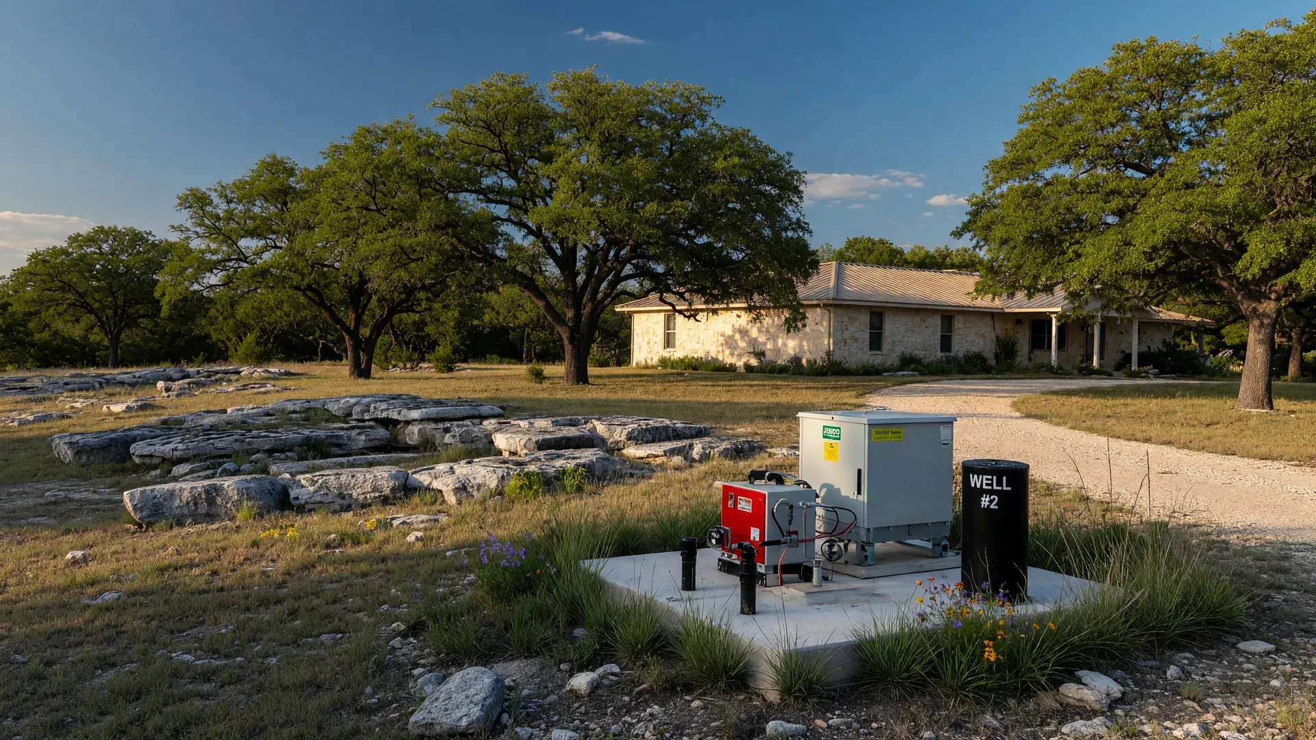
The Hill Country experienced one of the most severe drought periods on record in 2025. The Edwards Aquifer J-17 index well hit a 10-day average of 624.7 feet above mean sea level in May 2025, triggering Stage 5 restrictions for the first time in the aquifer's history [9]. As of mid-2026, the aquifer had recovered to approximately 644.8 feet, and restrictions had eased to Stage 2 [9].
For buyers evaluating a property with a private well, the drought history matters for two reasons. First, the well's performance during the drought period tells you whether it has adequate capacity for the dry conditions that will inevitably return. Second, wells that were drilled during or after the drought may have been completed at greater depths to reach a declining water table, which means the static water level on the completion report may be lower than the pre-drought norm [9].
Ask the seller whether the well experienced any reduction in flow or water quality issues during the 2024-2025 drought period. If the answer is that the well never went dry, that is a strong positive signal. If the seller does not know, or if the property was not occupied during that period, a current flow test and water level measurement are essential [9][10].
For properties drawing from the Trinity Aquifer, the drought impact is different. The Trinity responds more slowly to both drought and recharge, which means water levels are more stable but recovery from a severe drawdown takes longer. The Trinity is also less regulated than the Edwards, which means there is less public data available on water level trends in specific areas [4].
Practical steps for evaluating a well before closing
Here is the sequence I recommend for every buyer purchasing a property with a private well in the Hill Country.
Step 1: Obtain the well completion report. Request the driller's report from the seller or search the TWDB Submitted Drillers Report database using the property's well identification number [7]. If the well was drilled before 2003, the report may be available in the TWDB Groundwater Database.
Step 2: Review the completion report for red flags. Look for the red flags described above: low yield, SWL near total depth, missing data, or anomalous depth compared to neighboring wells.
Step 3: Order a current flow test. A licensed well driller or pump contractor can conduct a flow test to measure the well's current yield and static water level. The cost is typically $300 to $500 [1][8].
Step 4: Order a water quality test. A comprehensive potability panel from a state-certified laboratory covers bacteria, hardness, iron, hydrogen sulfide, pH, TDS, nitrates, and arsenic. The cost is $100 to $300 [10].
Step 5: Check the TWDB monitoring well data. The TWDB's groundwater data viewer provides historical water level trends for monitoring wells in the area. This tells you whether aquifer levels in the vicinity have been stable, declining, or recovering [2].
Step 6: Consult the local Groundwater Conservation District. Kendall County and surrounding areas are served by groundwater conservation districts that can provide information on local well performance, regulations, and any known issues in the area [8].
Evaluating a property with a private well?
I review well reports, flow tests, and water quality data with every buyer considering a property on well water. No guesswork, no assumptions, just the actual numbers for the specific property.
Contact Bill Ross | The Truth About Well Logs | Edwards Aquifer & Property ValuesFrequently asked questions
What is a good well depth for a Hill Country property?
There is no single ideal depth. The right depth depends entirely on which aquifer your property is on and which fracture zone the well intersects. In the Edwards Aquifer, wells at 150 to 300 feet are typical and productive. In the Trinity Aquifer, wells at 300 to 650 feet are common. The number that matters more than depth is the yield in gallons per minute and the static water level relative to total depth [2][4].
Can a well run dry in the Hill Country?
Yes, and it happens more frequently during extended drought periods. The 2024-2025 drought caused significant declines in both the Edwards and Trinity aquifers. Some wells in western Hays County saw water levels drop 20 feet or more [9]. The risk of a well going dry is higher in the Trinity Aquifer, where saturated thickness is often more limited, and in areas where neighboring wells are drawing from the same fracture system.
How much does it cost to drill a new well in the Hill Country?
A complete residential well installation in the Texas Hill Country typically costs $10,000 to $25,000. This includes drilling at $35 to $65 per foot, steel casing, submersible pump, pressure tank, and electrical hookup [1]. Wells that require deeper drilling through hard limestone or that encounter difficult geology can cost more. The cost is not guaranteed to produce a productive well, which is the risk you accept when buying a property without an existing well.
How often should a well be tested?
The Texas Well Owner Network recommends annual bacteria testing and a full potability panel every three to five years [10]. For properties where water quality has changed, or where there has been nearby construction, drilling, or flooding, test immediately. If you are buying a property, test during the option period regardless of when the last test was done.
What water treatment systems are typically needed for Hill Country well water?
Most Hill Country wells require a water softener to address hardness (calcium and magnesium at 10 to 25 grains per gallon) [10]. Many also require an iron filter for elevated iron levels and a hydrogen sulfide treatment system for sulfur odor. A sediment pre-filter is standard. For properties with bacteria concerns, UV disinfection is recommended. The total cost for a complete treatment system is typically $2,000 to $5,000 installed [10].
Does well water quality affect property value?
Yes, significantly. A property with a documented well producing 10+ GPM of good-quality water is worth more than an otherwise identical property with an undocumented well or a history of water quality issues. The cost of drilling a replacement well ($10,000 to $25,000) and installing a treatment system ($2,000 to $5,000) is a direct discount on the property's value when the well is not performing [1].
What is the difference between a well completion report and a well log?
In Texas, the terms are often used interchangeably. The well completion report (driller's report) is the official document submitted to the TWDB. The well log is the driller's narrative of the formations encountered at each depth interval. Both are part of the same document. For a detailed explanation of how to read the formation log section, see The Truth About Well Logs.
Sources
- Well Drilling Costs, "Texas Hill Country Well Drilling Cost 2026." Cost estimates for residential well drilling in the Hill Country, including per-foot rates and total installation costs. welldrillingcosts.com
- Texas Water Development Board, "Edwards-Trinity (Plateau) Aquifer." Regional aquifer overview, depth ranges, and water quality characteristics. twdb.texas.gov
- Edwards Aquifer Authority, "Current Conditions." J-17 index well data, pumping restrictions, and drought status for the San Antonio pool. edwardsaquifer.org
- Trinity Glen Rose Aquifer Education, "Trinity Aquifer Education." Depth ranges, yield variability, and water quality data for the Trinity Aquifer in the Hill Country. trinityglenrose.com
- USGS, "Quality of Water in the Trinity and Edwards Aquifers." Comparative water quality data including TDS, hardness, sulfate, and chloride levels. pubs.usgs.gov
- TWDB, "Ground-Water Resources of Kendall County, Texas." County-specific well data including aquifer distribution, typical yields, and water quality. twdb.texas.gov
- TCEQ, "Finding Information about Water Wells in Texas." Guide to accessing well completion reports, driller's report databases, and regulatory requirements. tceq.texas.gov
- Texas Groundwater Protection Committee, "Well Basics." Well construction standards, performance benchmarks, and maintenance guidance. tgpc.state.tx.us
- Texas Public Radio, "Edwards Aquifer rises after April rain, but drought remains" (April 2026). Current aquifer levels, drought history, and Stage 2/5 restriction context. tpr.org
- Hill Country Well Water Treatment, "Well Water Treatment in the Texas Hill Country." Water quality issues, typical treatment systems, and testing protocols. hillcountrywellwatertreatment.com
Last verified: July 20, 2026.
Published July 20, 2026
Updated July 20, 2026